

Online Collection
« Prev - 1 of 1 results - Next »
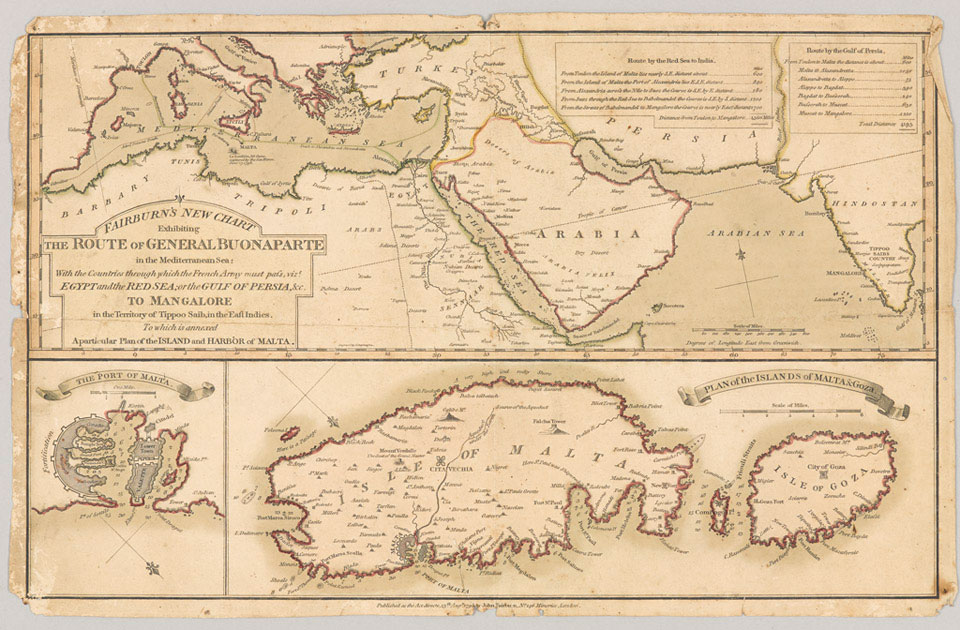
Map showing the route of the French military expedition force across the Mediterranean Sea to Mangalore in India, published by John Fairburn in 1798
Napoleon Bonaparte saw mapping as an important strategic tool and ordered the first detailed maps of Egypt. When the British Expeditionary Force landed there in 1801 they had little knowledge of the country. Colonel Robert Anstruther wrote, 'It is vain to refer to your maps. There are none but what the French may now have that are not the greatest botchpennies possible.'
The French military presence in the Middle East was part of a drive to join up with Tipu Sultan of Mysore and defeat the British in India. Napoleon Bonaparte believed that 'to destroy England truly, we shall have to capture Egypt.' The French forces sailed to Egypt via Malta, which had surrendered to them just a couple of months before this print was published.
NAM Accession Number
NAM. 1983-04-94-1
Copyright/Ownership
National Army Museum, London
Location
National Army Museum, Global Role gallery
Object URL
https://collection.nam.ac.uk/detail.php?acc=1983-04-94-1