

Online Collection
« Prev - 1 of 1 results - Next »
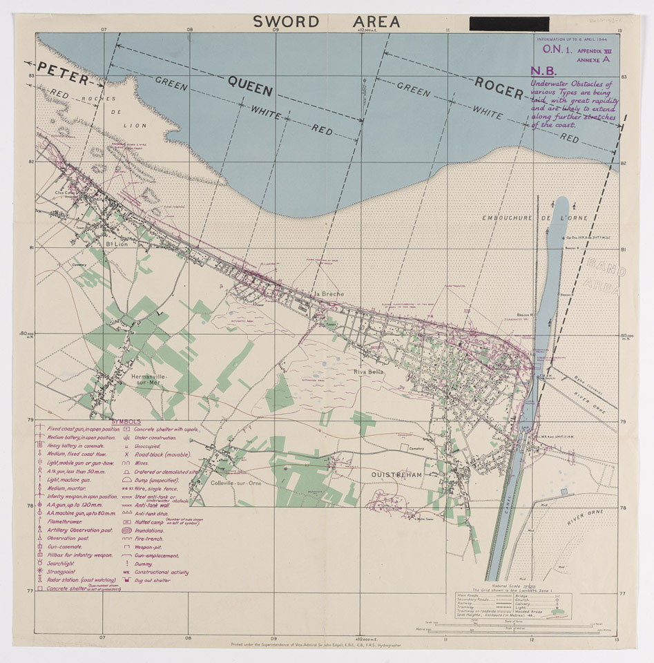
Map of Sword Area, 1944
Hydrographer, Vice Admiral Sir John Edgell. Marked 'Top Secret'.
Sword was the codename of one of the five landing beaches used during the Allied invasion of Normandy on 6 June 1944. On D-Day the 3rd Infantry Division, the 27th Armoured Brigade and elements of 79th Armoured Division landed at Sword.
One of five maps relating to D-Day, Operation OVERLORD, World War Two (1939-45).
NAM Accession Number
NAM. 1984-06-153-1
Copyright/Ownership
National Army Museum, London
Location
National Army Museum, Study Collection
Object URL
https://collection.nam.ac.uk/detail.php?acc=1984-06-153-1