Online Collection
« Prev - 1 of 1 results - Next »
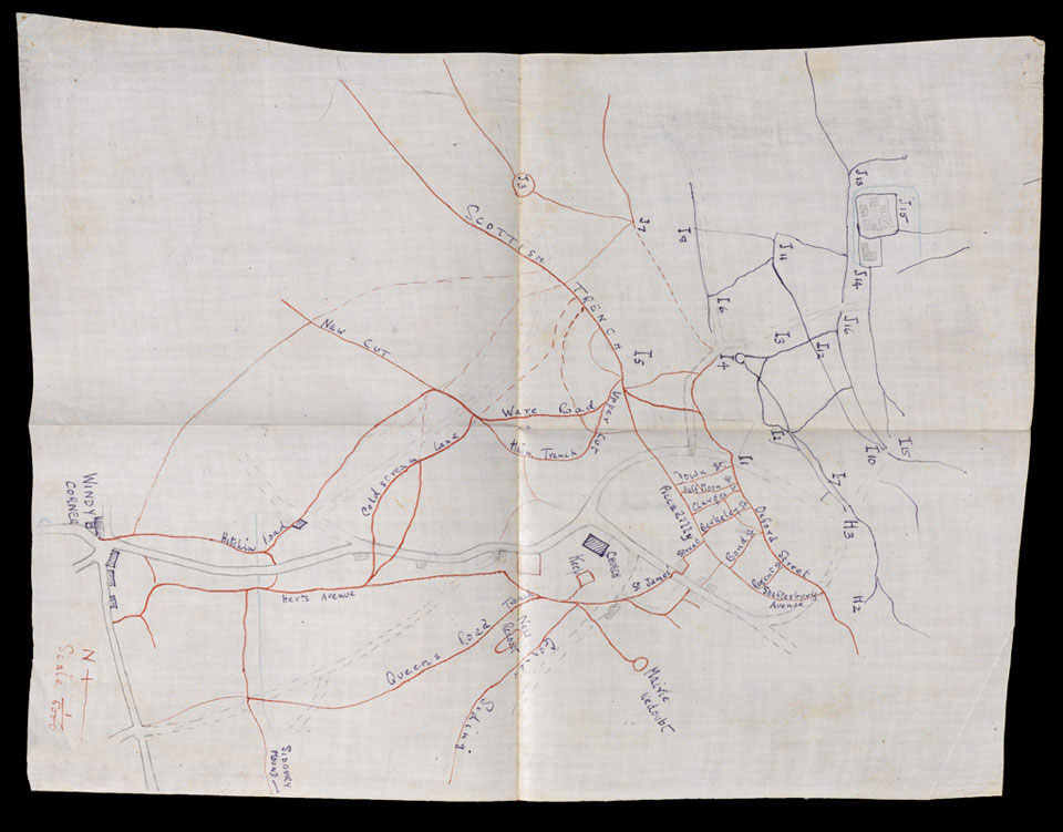
Trench map, captioned 'Trenches in Givenchy Hill (both sides) and their approaches', 1915
This hand-drawn trench map, inscribed on waterproof paper, details the British trench system in red ink and the known German trenches in blue ink. Buildings, roads and strongpoints are shown and a compass bearing and scale gradation is provided in the bottom right. The map belonged to Lieutenant Arthur Fancourt Logan, 2nd Battalion The Bedfordshire Regiment, who used it during 7th Division's unsuccessful attack at Givenchy on 15-16 June 1915.
From an album of compiled by Lieutenant-Colonel A F Logan MC, East Surrey Regiment and 21st Prince Albert Victor's Own Cavalry.
NAM Accession Number
NAM. 1995-06-89-1-46
Copyright/Ownership
National Army Museum, London
Location
National Army Museum, Study Collection
Object URL
https://collection.nam.ac.uk/detail.php?acc=1995-06-89-1-46

