Online Collection
« Prev - 1 of 1 results - Next »
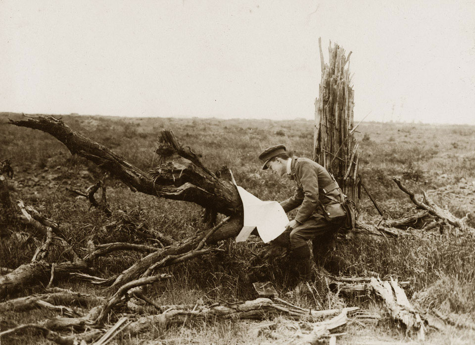
'Battle of Messines Ridge. An officer finds a German map', 1917
Photograph, World War One, Western Front (1914-1918), 1917.
Messines Ridge, high ground near the Ypres Salient, was captured on 7 June 1917 in a well co-ordinated assault. It began with a week-long artillery barrage. Allied intelligence, including captured maps, had provided the gunners with up-to-date plans of where German artillery positions were and by the time of the infantry attack around 90 per cent of German artillery guns in and around Messines had been knocked out.
As the barrage lifted the German defenders moved into their front line trenches to await the usual infantry assault, but this time the British detonated several explosive mines that had been dug underneath the German lines. Thousands of Germans were killed and many more left disorientated. In the immediate aftermath of the explosions, infantry from three corps attacked covered by an artillery rolling barrage. Within a few hours all their objectives had been taken.
From an album of 76 official photographs, 1916-1917.
NAM Accession Number
NAM. 1999-11-70--59
Copyright/Ownership
National Army Museum, Out of Copyright
Location
National Army Museum, Study Collection
Object URL
https://collection.nam.ac.uk/detail.php?acc=1999-11-70--59

