

Online Collection
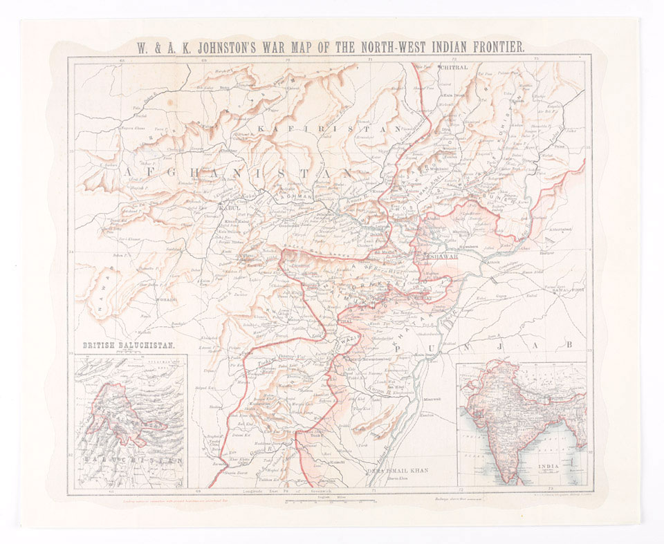
'W and A K Johnston's War Map of the North West Indian Frontier', 1897
3rd Edition, Edinburgh and London, 1897.
The North-West Frontier became part of British India in the aftermath of the Second Sikh War (1848-1849). Following its victory in that conflict, the British East India Company annexed the Punjab. In doing so, it also became responsible for the frontier regions with Afghanistan, which had been part of the Sikh Empire's territories. This frontier zone remained part of the Punjab until separated into the North-West Frontier Province in 1901.
The North-West Frontier was also divided into a so-called 'settled area' that came under direct British rule, and a largely autonomous 'tribal area' directly adjacent to the Afghan border. This latter zone was free from the trappings of colonial rule, such as courts, police and taxation.
This map was produced during the 1897 rising when nearly all the Pathan tribes of the frontier rose up in rebellion, threatening British control of the region.
NAM Accession Number
NAM. 1969-09-29-1
Copyright/Ownership
National Army Museum, Out of Copyright
Location
National Army Museum, Study Collection
Object URL
https://collection.nam.ac.uk/detail.php?acc=1969-09-29-1