

Online Collection
Map of Utah Area, 1944
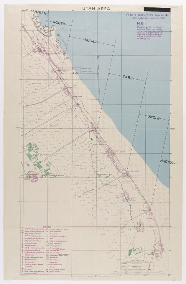
Hydrographer, Vice Admiral Sir John Edgell. Marked 'Top Secret'.
Utah was the codename of one of the five landing beaches used during the Allied invasion of Normandy on 6 June 1944. The American 4th Infantry Division, landed on the lightly fortified beach between Pouppeville and La Madeleine. They met fairly weak opposition and soon linked up with their airborne troops. By the end of D-Day, some 23,000 troops had safely landed on the beach at the cost of only 200 casualties.
One of five maps relating to D-Day, Operation OVERLORD, World War Two (1939-1945).
NAM Accession Number
NAM. 1984-06-153-4
Copyright/Ownership
National Army Museum, London
Location
National Army Museum, Study collection
Object URL
https://collection.nam.ac.uk/detail.php?acc=1984-06-153-4