

Online Collection
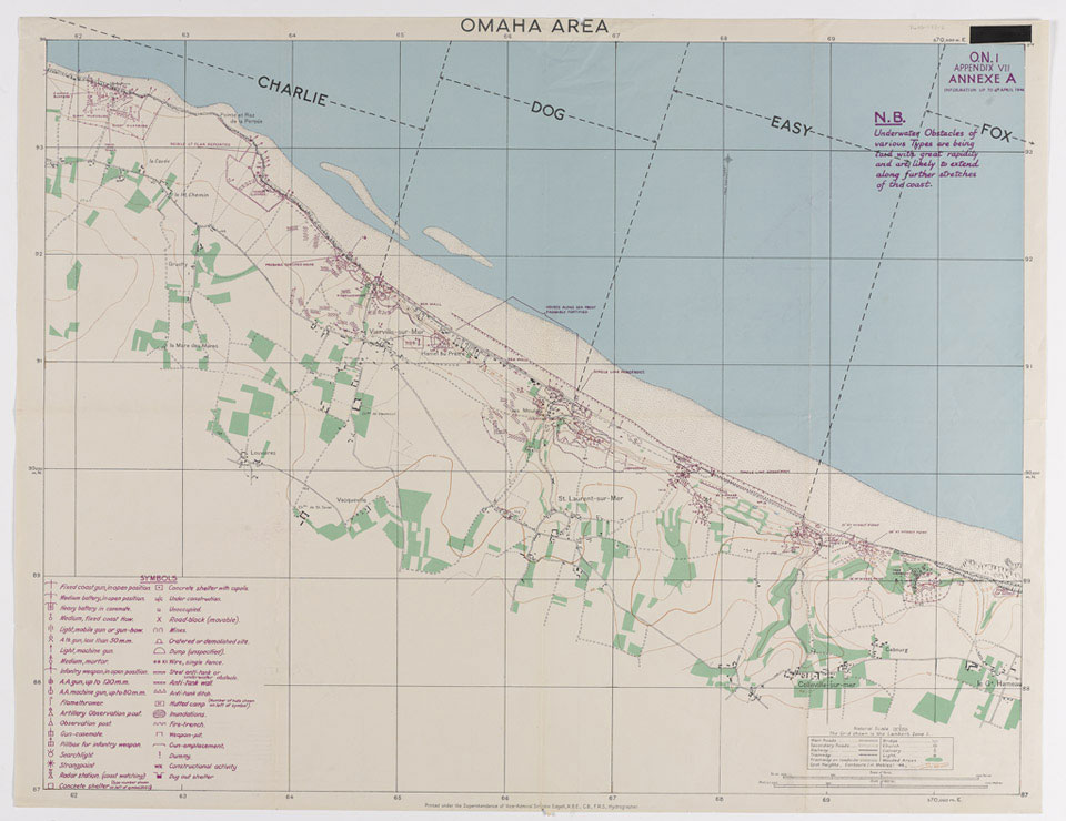
Map of Omaha Area, 1944
Hydrographer, Vice Admiral Sir John Edgell. Marked 'Top Secret'.
Omaha was the codename of one of the five landing beaches used during the Allied invasion of Normandy on 6 June 1944. It ran from Sainte-Honorine-des-Pertes to Vierville-sur-Mer. The American 1st and 29th Divisions that landed there faced high cliffs and a heavily fortified system of defence. The attackers soon ran into fierce German resistance and suffered very heavy casualties before securing a small beachhead. By the end of the day 34,000 men had been landed at the cost of nearly 3000 casualties.
One of five maps relating to D-Day, Operation OVERLORD, World War Two (1939-45).
NAM Accession Number
NAM. 1984-06-153-2
Copyright/Ownership
National Army Museum, London
Location
National Army Museum, Study collection
Object URL
https://collection.nam.ac.uk/detail.php?acc=1984-06-153-2